Glacier melt in Alaska heightens fears of record flooding
Stockholm, August 14 (Hibya) - According to the BBC, some Alaskans are evacuating their homes due to water leaking from a basin dammed by the Mendenhall Glacier, raising fears of record flooding in the state capital.
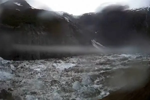
The National Weather Service (NWS) office in Juneau issued a flood warning as water from the glacier outburst flowed into the Mendenhall River, putting homes in the area at risk.
Local authorities have been warning residents for days that evacuation might be necessary. On Tuesday, they confirmed that water had begun seeping from the ice dam and flooding was expected in the coming days.
The glacier, a popular tourist attraction, is located 19 km from Juneau.
On Tuesday, the NWS said water levels had reached 3 meters, below the major flood threshold of 4.4 meters. However, on Wednesday morning, the water rose above 4.7 meters, considered a peak level.
Meteorologist Nicole Ferrin said at a press conference on Tuesday: "Based on all the information we have, this will be a new record."
The Juneau city website explains that glacier lake floods occur when a lake fed by melting snow, ice, and rain empties rapidly. This process is similar to pulling the plug from a full bathtub. When meltwater reaches a certain level, it can spill over the glacier that once held it back.
Alaska Governor Mike Dunleavy declared a state of emergency on Sunday due to a "catastrophic flood threat from a glacier lake (GLOF)" in the Juneau area.
Flooding in the area has been a yearly concern since 2011; homes have been damaged or swept away. Last year, hundreds of residences were damaged.
As global temperatures rise, mountain glaciers are shrinking.
Additional meltwater can accumulate to form glacier lakes. Scientists have observed an increase in their number and size since 1990.
Natural ice and rock dams holding these lakes can collapse suddenly and unpredictably, causing floods.
Researchers predict that climate change will increase the number of such sudden floods in the future.
Europe Asia News
 Facebook
 Tweeter
 Whatsapp